


By Dondor Giri Nongkhlaw
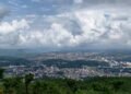
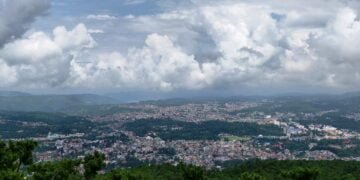
One hundred and thirty-seven years ago, Shillong, the Capital City of the Undivided Assam, and now the Capital of Meghalaya was non-existent. The evolution of Shillong from small and scattered hamlets into a big city of today owes its origin to the British Administration of Assam. Today, Shillong is a growing city, as it grows it is beset with problems of space resulting in the mushrooming growth of unplanned settlements plus a host of other problems like sanitation, water supply, narrow roads, traffic jams etc. However, the jovial and jolly character of its citizens offsets all these. Thus, its reputation as a centre of learning, as a health resort and centre of social and intellectual interactions spread far and wide.
Many world-famous personalities have visited, stayed and some of them died here. The names of such famous personalities may be mentioned here are Pope John Paul II, Verrier Elwin, the Anthropologist, E.P Gee, the Naturalist, C.V Raman, the Nobel Laureate Physicist and Rabindranath Tagore, the Poet Nobel Laureate. Even the modern science of Seismology owes its origin to the thorough studies of the Shillong Earthquake, 1897, by the famous Geologist R.D Oldham. Today Shillong has adapted to the western lifestyles in the backdrop of native traditions and culture in spite of its being a land – locked city
Nomenclature: The name of Shillong is derived from the name of the mountain – top of the state originally known as U Lum Shillong. This mountain -top is believed to be the abode of the God known as U Shulong, literally, ‘The one who exists by himself’. The original name got corrupted into Shillong to suit the British way of pronunciation and spelling
Genesis and History: At the end of the Anglo – Khasi wars in 1832, and with the arrest of U Tirot Sing, the King of Nongkhlaw state, the headquarters of the British Political Officer was shifted from Nongkhlaw to Cherrapunji in 1835. But due to heavy rainfall and the out- break of the Pnar rebellion in 1860, Cherrapunji proved to be inadequate both in terms of climate and location. The search for a better site then began in 1858 Captain Rowlatt, the then Deputy Commissioner of Khasi and Jaintia Hills District, appointed a Committee for the selection of a new site. After much searching, the committee recommended Ïewduh and the adjoining lands as suitable for the new site. Soon after in 1866 the headquarters was shifted from Cherrapunji. Shillong then gained impetus when it was made the political headquarters of Assam Province on the 20th March 1874, with Col. R H. Keating as the first British Chief Commissioner. But in 1905, the province was reorganised and Bengal was divided. The newly created provinces Eastern Bengal and Assam came into existence with Dacca as the capital, though Shillong remained as the summer capital. In 1912, Bengal was reunited and Assam again became the Commissioners’ province with Shillong as the capital. With the Government of India Act 1919 and further reorganization, Assam was made the Governor’s Province and Shillong became the capital of the new province with Sir Nicholas Dodd Beatson Bell as the first Governor of Assam. Shillong remained the capital of Assam till 1972 when Assam was reorganised for the creation of Meghalaya.
The Geographical Landscape: No human activities whatsoever can ever exist anywhere on the surface of the earth without the geographical landscape. The geographical landscape in terms of its physical attributes largely determines and shapes many aspects of man’s culture and his cultural activities. Therefore, we have to know and understand the physical settings of Shillong as these have a controlling effect on its growth.
Location and Extent: Shillong is located between 25° 6′ north latitude and 91° 9′ East longitude with an average height of 5000 feet or 1520 above M.S.L. Its present geographical area is approximately 120 square kilometres.
Geology Tectonics and Rock Types: From the examination and interpretation of fossilized remains and rock types which I had collected, some aspects of geology, tectonics and rock groups can be inferred. Plant fossils were collected near Shillong Peak and were found in a layer of rocks at an altitude of 6112 feet inclined at an angle of 40°. These rocks show signs of early metamorphism. The ripples-marked rocks were found at Laitkor Rngi at an altitude of 6107 feet. Then a thin layer of conglomerates were found near Ummawlong, Lawsohtun at a height of 5800 feet. These evidences, the plant fossils, the ripples – marked rocks and the conglomerates tell us that Shillong and its surrounding areas were once under the sea and were uplifted to its present form by slow, gradual and sometimes violent upliftment as indicated by the presence of igneous rocks. The rocks seen in present day Shillong are the Khasi greenstones in the Umkhen Valley and Mawiong, the granites south of Shillong Peak and north of Umiam Khwan near Diengiei Peak, the quartzites are found exposed at various localities particularly the Laitkor area, the sandstones found exposed at Mawblei, Nongrah, Lawjynriew Langkyrding etc. The conglomerates are seen on a thin layer in one location only near Ummawlong, Lawsohtun
Soils: The soil of Shillong, apparently due to the nature of topography and vegetation varies from place to place In the Dymmiew area covered by the Laitkor, Riat Laban and Upper Shillong Protected Forests, the soil at places appear black in colour with abundant organic matter especially where evergreen trees dominate. In areas where Pine trees dominate the soil is lateritic and red in colour. However, at many places the soil characteristics vary in terms of colour, texture and content. Thus, we can see in Shillong other types of soils like the brown soils, loamy soils, and clayey soils. In the low-lying areas of the isolated flat lands such as Pynthorbah and Langkyrding the soil is black and fertile and were once rich agricultural lands.
Vegetation: In all sincerity I find it difficult to describe the nature of vegetation cover once seen in Shillong. But based on soil studies it appears the vegetation was of the evergreen types which include trees known in Khasi as u pyrshit, diengngan, diengsning, diengtyrnem, diengsohliya, diengsohlang, diengtiewsaw etc. And these were probably profuse seen once. The type of vegetation that once grew in Shillong is testified by a place named Oakland where Oaks were once abundant and the Shillong Botanical gardens preserved most of the tree species found in the early days of Shillong. U Soso Tham, a Khasi Poet, has vividly epitomised the grandeur of a diengsning (Oak) at Umjasai in his poetry.
Animals: Natural habitats of animals have been greatly disturbed throughout the developing and evolutionary history of Shillong. Animals that were seen in Shillong in its early days were deers, stag, bears, monkeys, foxes, leopards and clouded tigers, squirrels, pheasants. Today, occasionally we may encounter foxes, leopards, snakes, squirrels and pheasants, that too only in the Dymmiew area. However, birds known locally as Kbeit, Simtung, Puhwieh, Langdkhur, Paitpuraw, Mrit, Lomi etc, are still seen. Migratory birds like the fruit eating flying foxes or bats are still seen and are still an annual winter phenomenon. Aquatic animals have long been wiped out. But in untouched water bodies like Shalynnai and Dohthli (Channa Sp) are still seen in the Wahkdait and Langkyrding streams, land tortoises known as ka Phraw and crabs are still seen in the water bodies of Ka Dymmiew.
Climate: The Climate of Shillong is that of the sub-tropical mountain climate type and is referred to as humid mesothermal thermal climate in empirical classification. The annual rainfall ranges from 2000mm to 2800nun. Mean annual temperature is in the range of 16 – 18°C. Of late, Shillong seems to have acquired an extreme type of climate. In winter temperature drops dramatically to minus 0° C., whereas during summer the temperature sometimes exceeds 21° C. With the coming up of concrete buildings in a congested and unplanned manner and the increase in the number of vehicles, heat islands in the central part of Shillong are found to occur in summer. Winds, sometimes destructive, like the one in 1989 where houses and trees have been uprooted and people killed, blow fiercely during March and early April and then in September to October. Cloudiness appears during the monsoons but in January or February the sky appeared devoid of clouds except for u Phriang jarut. Two local factors influencing the climate of Shillong are, ka Dymmiew Shillong and the Barapani reservoir. Ka Dymmiew or the Protected Forests act as a heat sink as well as a sink for pollutants of Shillong and have a soothing effect on the local climate. The Barapani reservoir is responsible for the cloudiness and occasional showers during November and February. In winter, frost is a common winter phenomenon.
Topography: Topographically, Shillong can be said to comprise of flat lands, flat mountain, cliffs, precipitous slopes, mounds, undulating topography which comprise the uniform, gentle, convex and concave slopes, valleys, gorges and spurs The highest part of Shillong is the Shillong – Kynton Sngi Range with an average height of 6200 feet. The undulating topography covers the whole of Mawlai right from Umjarain to Ïewrynghep and Nongkwar which ends abruptly into perpendicular cliffs of the Sunapani along the Wah Umkhrah upto Wah Ro Ro. From Nonglum and Mawroh the undulating nature ascends gradually to form the flat level lands of Pynthorbah, Langkyrding and Umkhrah where there is a steep climb to have another undulating feature covering Nongmensong to Happy Valley. However, Jaiaw, Riatsamthiah, Wahingdoh and Umsohsun have a moderately to steep topography, Mawkhar upto Ïewduh is undulating in appearance. The Mawprem area is characterised by moderate to steep slopes. The area between Umkhrah and Umshyrpi is highly undulating whereas the whole of Nongthymmai area can be said to have moderate to steep slopes along with Madanrting. The Laitumkhrah area except Nongrimmaw and Nongrimbah, is also of undulating nature. The whole of Malki is hilly with steep slopes. Such topography is also seen in the Risa and Cleve Colony area. Laban is another area covered by steep slopes but the undulating nature is again seen in the Lawsohtun area.
Drainage: Shillong is drained by two major streams, Umshyrpi and Umkhrah. The source of Wah Umkhrah is the Demthring originated from Nan Syiem, Laitkor. The Demthring is met at a junction in the Rynjah Lapalang area by another stream, Umnongrah which is again fed by Phud Pambriew, Phudbri and Umkoi of Nongrah, Phud Mawdamob and Wah Tepthoh of Happy Valley From the Demthring junction at Rynjah – Lapalang, the stream then flow by the name known as Umpling. The Umpling is fed by Wah Nuid of Mawpram and Umshyngiar of Lumdiengmet. From the Umpling bridge, the Umpling flows along the L – Shaped fault line where there is quartzite to form a waterfall known as Nohkaliar or Spread Eagle Falls. About 300 yards downstream it is joined by another stream Wahkdait, the Wahkdait is also known as Wahktieh and Wahnongkynphoiñin its sources. From the Wahkdait – Umpling junction Umpling takes a meandering U-Shape. From this point the Umpling flows slowly till it meets the Wah Nongthymmai at Demseiñiong. It is from this junction that the name Umpling disappears and it is then known as Umkhrah. The Umkhrah then meets Wah Pamdngiem near Sawphorlong, as it flows it meets the Umdiengsning of the Wards Lake and Oakland at Madan Koidi. Further downstream it then meets the Umsohsun Umsohsun has its sources behind the State Central Library where it is joined by Umkseh of Lady Keane College and Umdiengngan of Thembijoi. The Umsohsun is also joined by a stream, Wah Lakadeng that originates from Lum Ïewduh. The Umkhrah then flows along a winding course descending into waterfalls known as Sunapani where it meets the Umshyrpi to form the Wah Ro Ro. The smaller streams that first form the Umshyrpi are the Umkashi and Wahdienglieng, they meet together at a point now known as Farm Hordel and then flows by the name Umshyrpi. This stream meets Wahkdait at Dhanketi and Umiewrynghep that originate from Lummawrie at Woodland Hospital. After the Malki Playground, the Umshyrpi then meets the Um Rim near Crinoline Swimming Pool. As it flows in a winding course it meets Um Shaw Shaw and Umkynrud of Lumparing and Laban. At Oxford point near the cross roads to Kench’s Trace it meets Umsohkhlur and then further down it meets Umjasai. From this Junction it flows in a winding course taking a nearly round turn at Umshyrpi where it then cascades downstream to form two waterfalls known as Bishop’s Falls and Gunner’s Falls (Kshaid Lynnu). The Umshyrpi is also joined by two other streams known as Ummawpdang and Umsohlang of Nongkseh and Umlyngka. Umshyrpi meets Wah Umkhrah at a steep riparian point where it is then known as Wah Ro Ro. Today these streams can no longer be called streams in its true nature but are merely sewage systems with all types of pollutants imaginable.
The Cultural Landscapes: By the term cultural landscape, it means the modifications and imprints of human or cultural activities on the surface of the earth. The cultural landscapes that appear in the Shillong geographical landscape are brought by peoples of a different cultural background and forever changed its surface form The different cultural landscapes that emerged and seen today m the Shillong geographical landscape are as follows:
- Military Landscape:As per resolution of the site selection committee the areas south of Ïewduh hills was earmarked for military cantonment. The extent of military cantonment complete with well-defined boundaries and numbered pillars has a total geographical area of 490 594 acres including the Breamer estate but excluding the Rifle range at Lawsohtun. The rifle range at Lawsohtun was purchased by the Military Department but does not belong to the so-called British Territory, (See map of Shillong 1925). Another Military landscape established by the British in 1942 is the Happy Valley. Thus, these two occupies a sizeable area that today forms part of Shillong Urban Agglomeration where military culture like drills, parades, training etc form part of military way of life
- Administrative Landscape:With the establishment of the military cantonment in 1865, Govt Offices and Quarters also crept up side by side. By March 1866 the offices of the Superintending Engineer PWD the constabulary and other offices were shifted to Shillong. The Legislative building constructed in 1919 was burnt to the ground on the 6th Jan 2001, the govt. house was constructed in1874, then other offices came up like the Secretariat, the Shillong Secretariat Press, the Telegraph Office, the Treasury, the Executive and Judicial Offices also came up slowly. It is on such a landscape that bureaucratic culture and white-collar culture emerged with I.C.S. officers E.A.Cs Secretaries, Office Superintendents, Bara Babus or Head clerks, diarists peons chowkidars, chaprasis etc. All administrative buildings were made of wood with beautiful flower gardens. The administrative landscape was further extended with the establishment of regional headquarters of central offices like the Survey of India, Botanical Survey Zoological Survey etc
- Religious Landscape: The religions landscape began to take shape immediately with the shifting of the headquarters. The Rev Griffith Huges of the Welsh Mission came to Shillong in 1871 and the first church was started at Mawkhar in 1874 The Anglican Church was constructed in 1876. Next came the Catholic Church in 1890 started by the German Salvatorians with Fr. Otto Hopfenmulleras the first mission superior. Next, the Unitarian Church was started by u Hajom KissorSingat Laban in 1896. Two prominent Unitarian Church leaders who helped the spread of Unitarian Church were Dr J. Thomas Sunderland and Ms Annie Margarett Barr both of the U. K. Other religious sects that emerged in Shillong are the Hindu Mission who established the Laban Sanatan Dharma Sabha in 1896. Then the Brahmo Samaj in 1866 The Rama Krishna Mission came first at Laban in 1934. The Muslim faith came to Shillong in 1866 and soon started the Police Bazar Masjid then the Laban Masjid and Laitumkhrah Masjid. The Sikh faith came to Shillong during the 1st World War and established the Gurudwara in 1920 at Police Bazar. Now, all these different faiths with all their beliefs, teachings and ways of worship made quite an imprint on the Shillong geographical landscapes. The places of worships like churches, temples, masjid and Gurudwaras not only occupy space but also change the skyline of Shillong. The imprint of the different religious activities on the geographical landscapes also appear in the form of landscape of the dead where Christian’s cemeteries, Muslim burial ground, Chinese graveyards, Hindu and Khasi cremations sites are today seen in many pockets of Shillong.
- Commercial Landscapes:The ancient Ïewduh being the biggest market of the Khasis even before the advent of the British, gained impetus from the usual one-day affair into a daily market At present there are as many as hundreds of shops spread all over Shillong where there are sellers and vendors of perishable goods to housing materials and other modem gadgets. The commercial landscape is further changed with the establishment of bank like the State Bank, Central Bank, UCO Bank etc. The first bank in Shillong was the Imperial Bank, the premises of which it is occupied by the present State Bank at Cutcherry.
- Recreational Landscape:The traditional recreational avenues of the Khasis are archery, angling and hunting for the adults, for children the recreation were ka mawkynting, climbing an oily greasy pole where prizes were fixed at the top of the pole, pegged top spinning, ka ïahai, jumping and racing and the most interesting of all is Ka Ïabam Khana Shnong or community picnic, and ka Pynher Panur or hot air balloon flying. These recreational activities do not have much impact on the geographical landscape as the games are played at different seasons and do not need permanent structures or playground. The British to while away their time during peaceful situations brought with them their own version of recreational activities such as Rodeo, Cricket, Golf, Football, Polo, Badminton, Lawn tennis. Billiards and Horse racing, ball room dancing and drinking bars. These types of recreation need specific spaces which always are of a permanent nature. Thus, the geographical landscape of Shillong was further changed with establishment of the Shillong Gymkhana for Horse racing, the Golf Links, Cricket ground at Laban, Pologround for Polo, Football ground. Lawn Tennis and Badminton court in the European portion of Shillong
- Educational Landscape:In order to educate the children of the British Military officers. Regimental school were started in the Cantonment Soon the need for education the children of Anglo-Indians and children of workers of the Raj arose. Outside the Cantonment the first school was started by the Chaplain of Shillong in 1881. The Khasi Jaintia Girls High School was started in 1892, the Shillong Govt Boys High School was started in 1875, the Jail Road Boys High School was started in 1913,the Anupchand Hindi High School in 1926,the Islamic Madrassa High School in 1920,the Loreto Convent in 1909 and the Irish Brothers started the St. Edmund’s School and College in 1916. In 1910 the Salvatorian Sisters started the St. Mary’s High School. The St Anthony’s School was started in 1922 and the St Anthony’s College in 1934,the Laban Boys School in 1923, the Laban Girl School in 1902, the Lady Keane College and School in 1932. Today Shillong has around 300 Schools and 21 Colleges and Universities. Some of the Schools and Colleges have earned the distinction as educational centres of excellence in the country. The educational landscape further changed the geographical landscape as space for school buildings and school playground are needed.
- Healthcare Landscape:In the early days of Shillong the only centre for medical aid and health care was the Station Hospital now known as the Military Hospital which catered only to the British and Military personnels of the time. As appeared in the map of Shillong 1925 the number of health care centre was only seven and one Veterinary Hospital at Qualapatty. The health care centres existed in the 1920s is the Minto Nursing Home at Red Hill Laitumkhrah, the Heath Convalescent Home at Laimer now occupied by the Meteorological Observatory. The Pasteur Institute famous worldwide for the manufacture and export of anti-Rabbles Vaccines. Then, there is the Earle Sanitarium near Wards Lake, the Civil Hospital at Police Bazar now shifted to Lady Hydari Park, The Laban Dispensary at Laban is the oldest dispensary in North East India today. Then the Welsh Mission Hospital with separate wards for Europeans and local public and the Ganesh Das Hospital for Women at Pasteur Hill. Today Shillong has around ten Hospitals and a number of dispensaries.
- Road Landscape:The road landscape emerged immediately with the establishment of the Cantonment and Civil station. The oldest road to Shillong is the Cherra – Shillong Road followed by the Guwahati – Shillong Road. Today nearly every household in Shillong is approachable by roads and in some cases cemented footpaths. The British apparently never envisioned that Shillong would be a big city as it is today. Most of the roads once suitable for the vintage cars of yesteryears are today too narrow for modern vehicles with increasing numbers each day. The impact of the road landscape on the Shillong geographical landscape can be better understood and assessed if one look at a road map of Shillong and drive around.
- Linguistic Landscape:All the above cultural landscape bears theimprints of language in many ways. The Shillong geographical landscape is from time immemorial have been imprinted by linguistic landscape that appears in the form of place names. Place names often survive long after the culture that produces them has vanished from the area. Place names or toponyms in Shillong was produced predominantly by the Khasis. Khasi place names like Mawlai Jaiaw, Nongthymmai etc still exist today, similarly British place name in Shillong like Maxwellton, Oxford Mission, Broookhaven, Crinoline, Braemar Bonnie Brae. Brightwell, the Brook etc still exist today though the British has gone long since Independence. Other aspects of the linguistic landscape are names given to streams, rivers like Umkhrah, Umshyrpi etc forests, official residences etc. Even the warning boards posted at different localities by respective village councils form part of the linguistic landscape.
Conclusion: The geographical landscape of Shillong though dealt and examined individually do not exist in isolation they interact within themselves. The interplay, interaction and relationships of these various geographical landscapes produce and nourishes many form of physical, biological and cultural and take place within a definite framework known as the physical environment giving rise to natural systems known as ecosystems. On the other hand, the various cultural landscapes that we have seen are brought about by man’s various activities. All these cultural landscapes with the exception of Ïewduh and military cantonments merge, blend and sometime overlap with each other with no sharp boundaries between them. All these aspects of cultural land scape are viewed as functional cultural ecology which is a part of Human Ecology. The understanding of the geographical and cultural land scape of Shillong can equip us with firm knowledge for better planning and management in making Shillong the most beautiful and peaceful city in this part of the world.
As of today Shillong is expanding at a fast pace that places such as Lad Nongkrem, Lad Smit and villages like Mylliem, Umroi and Mawkhanu have become part of the Shillong Urban landscape. The toponym or place-name Mawkhanu was a Nepali khuti but its original name is MAWKHAN meaning a Divining Stone, the Nepalis always pronounced MAWKHANU, for information there is no Khasi Village that ends with “U”. I hope the authorities and the villagers will correct the spelling and pronunciation of this village.
(The writer is former Head of the Department of Geography, Synod College, Shillong)