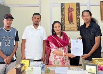













The Jaiñtia Hills Solidarity and Welfare Union (JHSWU) has requested the Manohar Parrikar Institute of Defence Studies and Analysis for recommendation to the government of India for restoration of the Jaiñtialand according to the pre-1951 map so that the Jaiñtias could live in peaceful existence and follow their tradition and custom freely now and in the future.
It may be noted that the Manohar Parrikar Institute of Defence Studies and Analysis on the directive of the Government of India has started a study on the boundary disputes between states of the North East.
JHSWU on January 5 this year had submitted a memorandum to the Director General of Manohar Parrikar Institute of Defence Studies and Analysis, Sujan R. Chinoy to apprise the institute of the history of the unconstitutional act of the then Assam government committed in 1951 leading to the deprivation of the Jaiñtias of a large part of their traditional home, now popularly known as Block-I and Block-II.
In a brief statement submitted to the institute, the JHSWU stated, “A large chunk of Jaiñtia Hills, the very small abode of the Jaiñtia left of their larger kingdom was unconstitutionally detached, transferred and mechanically tagged with the non-adjoining and truncated Mikir Hills (now Karbi Anglong) in April 1951 very soon after the promulgation of the Constitution of Independence India on January 26, 1950″. Part X (Article 244) and Part XII (Article 275) along with the Fifth and Sixth Schedules adequately provide for the protection and fiscal assistance to the Scheduled and Tribal Areas in the country. But the then Assamese government had meddled with the tribal areas against the Constitution and against the ethno-geography and geo-polity of the hill tribes in the region hardly fifteen months after the Indian Constitution came into force.”
JHSWU also stated that the British annexed the Jaiñtia Kingdom in 1835 and confined the Jaiñtias to their hilly country which was ratified by Constituent Assembly according to the Constitution of Independent India approved on November 26, 1949 and promulgated on January 26, 1950. But then government of Assam detached a large portion of the Jaiñtia Hills comprising of one Dalloiship (Nongphyllut) and one Sirdarship (Langsoh-Mynriang) and mechanically tagged with the truncated Mikir Hills for creating the new United Mikir and North Cachar Hills District on April 13, 1951.
“Geographically the Jaiñtia Hills and the Mikir Hills are in no way adjoining to each other. Even historically and culturally the two tribes are poles apart from each other. When a new district of United Mikir and North Cachar Hills was created in April 1951, the then government of Assam denied the Mikirs the plains portion particularly the Lumding’s north-east region where the Mikirs are predominantly concentrated. Instead of attaching this plains portion to the new district as demanded by the Mikirs, the then Assam government had arbitrarily sought to transfer a large chunk of Jaintia Hills to the Mikir Hills which are hundred kilometre apart from each other thereby bypassing the provision of the Constitution of India for protecting the Scheduled and Tribal Areas of the respective tribes,” the JHSWU said.