


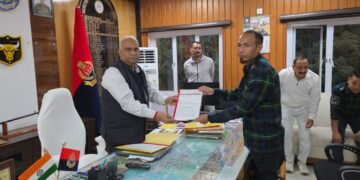







Amid strong objections from many quarters regarding the haste with which the Meghalaya government signed the Memorandum of Understanding (MoU) with Assam to settle the boundary dispute in six areas, there are also demands for public disclosure of the contents of the MoU and the areas affected by the boundary agreement.
According to the MoU signed between Meghalaya Chief Minister Conrad Sangma and Assam Chief Minister Himanta Biswa Sarma on March 29, it was shown that in Tarabari area of West Khasi Hills, the villages of Upper Tarabari/Walkam, Rangkhet, Thangkhola, Chingipa/Chinginde, Doini Charadonu, Dapbolpara and Bolkam comprising an area of 4.69 sq km will be with Meghalaya as per boundary delineated on the map of Meghalaya in their claim of 2011. Malang Salbari village “situated in Assam and outside the claimed area” will continue to be in Assam.
In Gizang area, out of the claimed area (13.53 sq km), the villages of Amagaon and Gohanimara comprising of an area of approximately 2.90 sq km will be with Meghalaya and the rest approximately 10.63 sq km comprising of Malsapara village, part of Gizang Reserve Forest and a buffer area on the western boundary of Gizang Reserve Forest falling in the claimed area will be “retained with Assam for protection of the Reserve Forest subject to detailed survey”.
In Hahim area, out of the claimed area of 3.51 sq km, the villages of Rongthali, Ranighat, Athiabari, Thamnaguri/Sonakuri, Mathaphuta/Umshiak, Maspara, Moipara, Malapara/Nalapara, Simrang (Umsaitwait) and Simrang/Salpara comprising an area of approximately 3.21 sq km will be with Meghalaya. The remaining 0.30 sq km approximately comprising Thutiapara/Tutia Bazar will be “retained” with Assam.
The boundary for the transferred area will be along the right bank of Gizang River and left bank of Umtyrsung River excluding the area of Tuthiapara village (0.30 sq km approximately) up to the confluence of these two rivers. Lejadubi village falls outside the claimed area and is found to be within Meghalaya as per spatial coordinates provided by Meghalaya.
In Ri-Bhoi district, in Boklapara area, out of the claimed area of 1.57 sq km, two villages namely Boklapara and Hawla with an area of approximately 0.56 sq km will be with Meghalaya and two villages namely Jimrigaon and Lyngkhung with an area of approximately 1.01 sq km will be “retained” in Assam.
In Khanapara-Pillangkata area, out of the claimed area of 2.29 sq km, a total of approximately 0.50 sq km (parts of the villages of Maikhuli, Pillangkata and Borpathar stone quarry area) will be with Meghalaya. Further, in Khanapara area, out of 0.08 sq km demanded during discussions, it was agreed that the ASTC Transit Camp to police outpost, Naamghar, Assamese inhabited areas of 1 No of Khanapara village and Dreamland Resort area totaling approximately 0.03 sq km will be with Assam. The rest of the 0.05 sq km area including the entire apartment complex of Brahmaputra Realtors Pvt Ltd will be with Meghalaya.
In the rest of the portions between ASTC Transit Camp to Dreamland Resort, the boundary will be along the road connecting to the GS Road. In Patarkuchi area, areas inhabited by Garos and other ethnic communities of Meghalaya and their religious and cultural places, if any, will be included in Meghalaya during detailed survey. In Maikhuli area, Muamari Beel, which is adjacent to Maikhuli playground will remain with Assam and the Maikhuli graveyard will be with Meghalaya. “Thus overall Meghalaya will get approximately 0.55 sq km and Assam will get approximately 1.74 sq km,” the MOU stated.
In the Ratacherra of East Jaintia Hills, out of the claimed area of 11.20 sq km, a total of approximately 6.42 sq km comprising the villages of Malidor, Ratacherra and Umperdit border will be “transferred” to Meghalaya. The status of Borail Wildlife Sanctuary “will remain unchanged irrespective of jurisdictional change in pursuit of environmental conservation”. The remaining approximately 4.78 sq km of Baleswar Grant revenue village “shall be part of Assam”.
The boundary of the transferred area will be along the right bank of Baleswar River. The “control” over Baleswar River and the Malidor bridge “will be with Assam”. However, Assam has assured the Government of Meghalaya that the river will not be used for commercial mining so far as this stretch is concerned.