

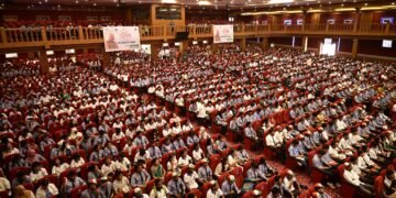


A one-day workshop on ‘Geo-Spatial Applications for Natural Resource Management in Meghalaya’ was conducted by the GIS LAB under the Centre of Excellence (CoE), MBMA here yesterday.
The workshop was aimed to create awareness about different geo-spatial applications for natural resource management being done by different departments and how we all as a community of the stakeholders can complement and supplement each other for the larger benefits for the State.
It also aims to provide a platform for interaction between the GIS analysts within the MBDA family particularly at the district units and also with experts from other departments and institutions.
Panellists who attended the workshop suggested all government departments to list spatial data they posses and activities conducted while the MBDA to volunteer and host similar workshop on geo spatial applications after selection of a nodal person to represent the GIS team.
They also suggested proper mechanism for regular meetings and workshops, collaboration between different departments, framing of guidelines and protocols by the Planning department and setting up of a State Spatial Data Infrastructure for spatial data depository.
According to the organisers such workshop would create wide awareness in the departments and individuals associated with the natural resource management, environment, conservation and developmental activities about the use of spatial data in the State.
Director of MBDA/MBMA CoE Dr S. Ashutosh, Prof OP Singh from the Department of Environment NEHU, Dr. M. Stalin, Director SOI, Prof H Syiemlieh, Dept. of Geography and Gunanka DB, Executive Director MBDA and Additional Project Director CLLMP/MegLIFE attended the workshop.
Officials from NESAC, ESRI India, Forest Department, Soil & Water Conservation Department, Water Resource Department, Agricultural Department, ADCs from Khasi and Jaintia Hills, NIC, MOEF & CC, NEHU and MBDA/MBMA also took part in the workshop.