










Shillong, Nov 15: One of the arguments in favour of the Shillong Peak Ropeway project is that it will reduce carbon emissions by cutting the distance travelled by tourists to reach the Shillong viewpoint.
However, one consequence of the proposed tourism initiative is that it could lead to a worsening of traffic in the neighbourhoods nearest the lower terminal of the project, namely in Greater Laban.
Because Laban (designated as Planning District No. 8 in the Shillong Master Plan 2041) is a densely populated residential neighborhood with steep terrain, road widths vary significantly by street type.
Internal lanes are only 3 to 5.5 metres wide and some are barely one car’s width. Main roads are wider at 7 to 12 metres but parking on the sides of these restricts their passage.
According to details presented by the Meghalaya Institute of Governance (MIG) in its public consultation, the ropeway’s lower terminal point at Lawsohtun will have parking for 258 four-wheelers and a mere 50 two-wheelers “for the time being”.
Under the MIG’s estimates, by 2040 some 3,800 to 8,100 passengers will be using the ropeway every day.
Although not mentioned in the MIG report, discussions with stakeholders have broached the subject of a dedicated access road to the Lawsohtun terminus.
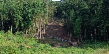
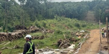
Whether this follows an existing road that will be widened or the creation of a brand-new road, more tree-felling is likely to accommodate it. More than 500 trees have already been cut down to pave the way for the project at Lawsohtun. More may have to be sacrificed just to get the tourists to the site itself.