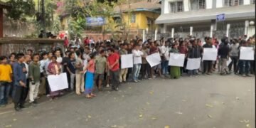


The regional boundary committee headed by Deputy Chief Minister Prestone Tynsong will hold its second round of meeting on November 30 to discuss on the disputed border areas of Borduar, Nongwah-Mawtamur, Deshdoomreah and Block-II which fall under Ri-Bhoi district.
The regional boundary committee for Ri-Bhoi which is headed by Tynsong also comprised of cabinet minister Dasakhiat Lamare, Nongpoh MLA Mayralborn Syiem, KHADC Executive Member Jambor War, Umroi MDC Rangkynsai Kharbuki and Deputy Commissioner and Ri-Bhoi Deputy Commissioner as Member Convener.
Earlier, the Khasi Hills Autonomous District Council (KHADC) had asked the traditional heads of Hima Mylliem, Hima Nongspung, Hima Jirang and Raid Nongtung to submit land documents with regards to their respective claims over the lands falling under the four areas of difference in Ri-Bhoi district, before November 30.
Hima Mylliem has assured to submit the land documents pertaining to Deshdoomreah (457 sq km), which used to be called as Khadar Bongtha.
While Hima Nongspung is claiming the eight villages under Borduar (147 sq km), Hima Jirang has staked claim to 14 villages under Nongwah-Mawtamur. Hima Raid Nongtung however is claiming the 22 villages under Block II.
It may be mentioned that the State government has formed three separate regional boundary committees for Ri-Bhoi, West Khasi Hills and West Jaintia Hills to pursue the second phase of boundary settlement with Assam in twelve areas.
The committees will coordinate with the relevant regional committee set up by the Assam government.
They will also have to cross-reference and verify the names of the villages (sub-villages) claimed by Meghalaya with the names of villages as per records of the Government of Assam.
They will also establish the geographical location of the villages and their contiguity and examine the status of the population of villages as per census records, including ethnicity.
Besides preparing a register of public assets in the villages, created by both state governments, the committees will visit each village and interact with the communities living in the villages, including the elected representatives of the Autonomous District Councils and other stakeholders to learn about the perception of the people living in the area.
The committees will sort out the boundary issue based on the inspection of the villages and based on the agreed yardsticks of historical perspective, ethnicity of the local population, administrative convenience of local people, contiguity with the boundary and the perception of the people living in the area.