


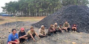


Forest cover in seven hill districts of Meghalaya has shown a decrease of 73 square kilometres.
This was revealed in the India State of Forest Report 2021 released on January 13.
As per definition in the report, hill districts are those which have 2/3rd area as hills.
The forest cover in all eight states of the North East region is also showing a decline, as per the report.
Arunachal Pradesh, that has 16 hill districts, has shown a loss of 257 square kilometres of forest cover compared to the 2019 assessment, Assam’s three hill district (-107 sq km), Manipur’s nine hill districts (-249 sq km), Mizoram’s eight hill districts (-186 sq km), Meghalaya’s seven hill districts (-73 sq km), Nagaland’s 11 districts (-235 sq km), Sikkim’s four districts (-1 sq km), and Tripura’s four districts (-4 sq kms).
The total forest cover in the North East region is 1,69,521 square kilometres, which is 64.66 per cent of its area. The current assessment shows a decrease of forest cover to the extent of 1,020 square kilometres (0.60 per cent) in the region.
Incidentally, Assam, as a whole, has shown smaller negative change (-15 sq km) compared to just three of its hill districts (-107 sq km).
The North East states account for 7.98 per cent of total geographical area but 23.75 per cent of total forest cover. The decline in the North East states has been attributed to a spate of natural calamities, particularly landslides and heavy rains, in the region as well as to anthropogenic activities such as shifting agriculture, pressure of developmental activities and felling of trees.
The India State of Forest Report 2021 divides forests into distinct categories according to density of canopy: very dense forest (VDF), moderately dense forest (MDF) and open forest (Open).
The top three states showing an increase in forest cover are Andhra Pradesh (647 sq km) followed by Telangana (632 sq km) and Odisha (537 sq km).
Area-wise Madhya Pradesh has the largest forest cover in the country followed by Arunachal Pradesh, Chhattisgarh, Odisha and Maharashtra.
In terms of forest cover as percentage of total geographical area, the top five states are Mizoram (84.53 per cent), Arunachal Pradesh (79.33 per cent), Meghalaya (76.00 per cent), Manipur (74.34 per cent) and Nagaland (73.90 per cent).
17 states and union territories have above 33 per cent of the geographical area under forest cover. Out of these states and union territories, five states/union territories namely Lakshadweep, Mizoram, Andaman & Nicobar Islands, Arunachal Pradesh and Meghalaya have more than 75 per cent forest cover while 12 states/ union territories namely Manipur, Nagaland, Tripura, Goa, Kerala, Sikkim, Uttarakhand, Chhattisgarh, Dadra & Nagar Haveli and Daman & Diu, Assam, Odisha, have forest cover between 33 per cent to 75 per cent.
The report also stated that forest cover in the 140 hill districts of the country has shown a decrease of 902 sq km (0.32 per cent).
As per the current assessment, the total forest cover in the hill districts is 2,83,104 sq km, which is 40.17 per cent of the total geographical area of these districts.
The report also showed that in the case of the other districts in the Himalayan states and union territories, not all have shown decline.
West Bengal’s sole district has shown a slight decline (- 18 sq km), Jammu & Kashmir’s 22 districts (29 sq km), Ladakh’s two districts (18 sq km), Uttarakhand’s 13 hill districts (2 sq km) and Himachal Pradesh’s 12 districts (9 sq km).